


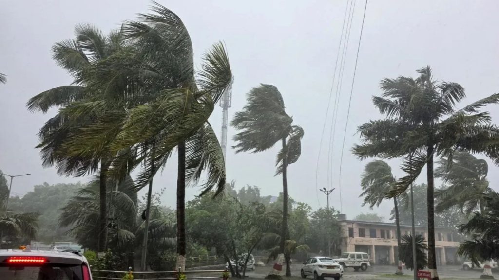
New Delhi: A new weather system is developing in the Bay of Bengal, which could intensify into a cyclonic storm in the next 24 to 48 hours. According to the India Meteorological Department (IMD), the low pressure area over the southeastern Bay of Bengal is expected to first intensify into a deep depression and then into a cyclonic storm by the evening of November 16th. This storm will be named ‘Akvan’, a name given by Iran.
According to the Meteorological Department’s bulletin issued on Saturday, this system will move northwest and could intensify into a cyclonic storm over the central Bay of Bengal. Due to this, strong winds and high seas are expected in the Bay of Bengal, Andaman Sea, and Andaman and Nicobar Islands.
IMD issues alert, wind speeds could reach 80 km per hour
According to the IMD, a well-marked low-pressure area was formed over the southeastern Bay of Bengal at 5:30 am on Saturday. Due to this, bad weather is expected in the Andaman Sea, Andaman and Nicobar Islands, and many parts of the Bay of Bengal.
The Meteorological Department has predicted wind speeds reaching up to 60 km per hour in these areas. Furthermore, wind speeds may increase to 80 km per hour from November 17th. Wind speeds are expected to remain at this level for the next two days.
In view of the possibility of rough seas and strong winds, the IMD has advised fishermen to return to shore by November 15th. A warning has also been issued against venturing into the sea for the next few days.
The Meteorological Department is continuously monitoring the direction and intensity of this system. It is expected to strengthen further in the coming days.
LG of Andaman and Nicobar Islands says administration is prepared to deal with any situation
In view of this weather system developing in the Bay of Bengal, Lieutenant Governor of the Andaman and Nicobar Islands, Dinesh Sharma, has stated that the administration is fully prepared to deal with any emergency.
He stated that the disaster management force in the islands is fully alert. Furthermore, the Navy, Air Force, and Army have also been placed on high alert.
Dinesh Sharma said, “Our disaster management force is always fully prepared. The Navy, Air Force, and Army are all on high alert in our islands. While preventing natural disasters is beyond our control, we ensure that circumstances that could exacerbate the impact of a disaster do not arise. If an unfortunate situation arises, all necessary safety measures are immediately put in place. There is no need to worry at this time. Small cyclones usually come and go.”
The administration is continuously monitoring the weather conditions and preparations are being made to deal with potential emergencies in the islands.
Third major weather system after Arnab and Murasu
This is the third major weather system developing in the Bay of Bengal to impact the region in recent weeks. Earlier in October and November, Cyclones Arnab and Murasu hit Andhra Pradesh and surrounding areas, bringing strong winds and heavy rainfall.
On October 28, Cyclone Arnab made landfall near Narsapur as a very severe cyclonic storm. Wind speeds of 125 to 135 kilometers per hour were recorded, with gusts reaching 150 kilometers per hour. At least six people died due to this storm.
Subsequently, on the morning of November 3, Cyclone Murasu crossed the coast of southern Andhra Pradesh near Ongole as a severe cyclonic storm. Wind speeds of 100 to 110 kilometers per hour were recorded, with gusts reaching 120 kilometers per hour.
Murasu’s impact was also felt in coastal Andhra Pradesh and parts of Telangana. Very heavy rainfall was recorded in these areas on November 5th.
Another weather system is now strengthening in the Bay of Bengal. The IMD is closely monitoring its direction and intensity. Cyclone Akvan is expected to develop by November 16th. Even then, caution will be needed for strong winds and rough seas for the next few days.