Last Updated: October 16, 2026
Last Updated: October 16, 2026





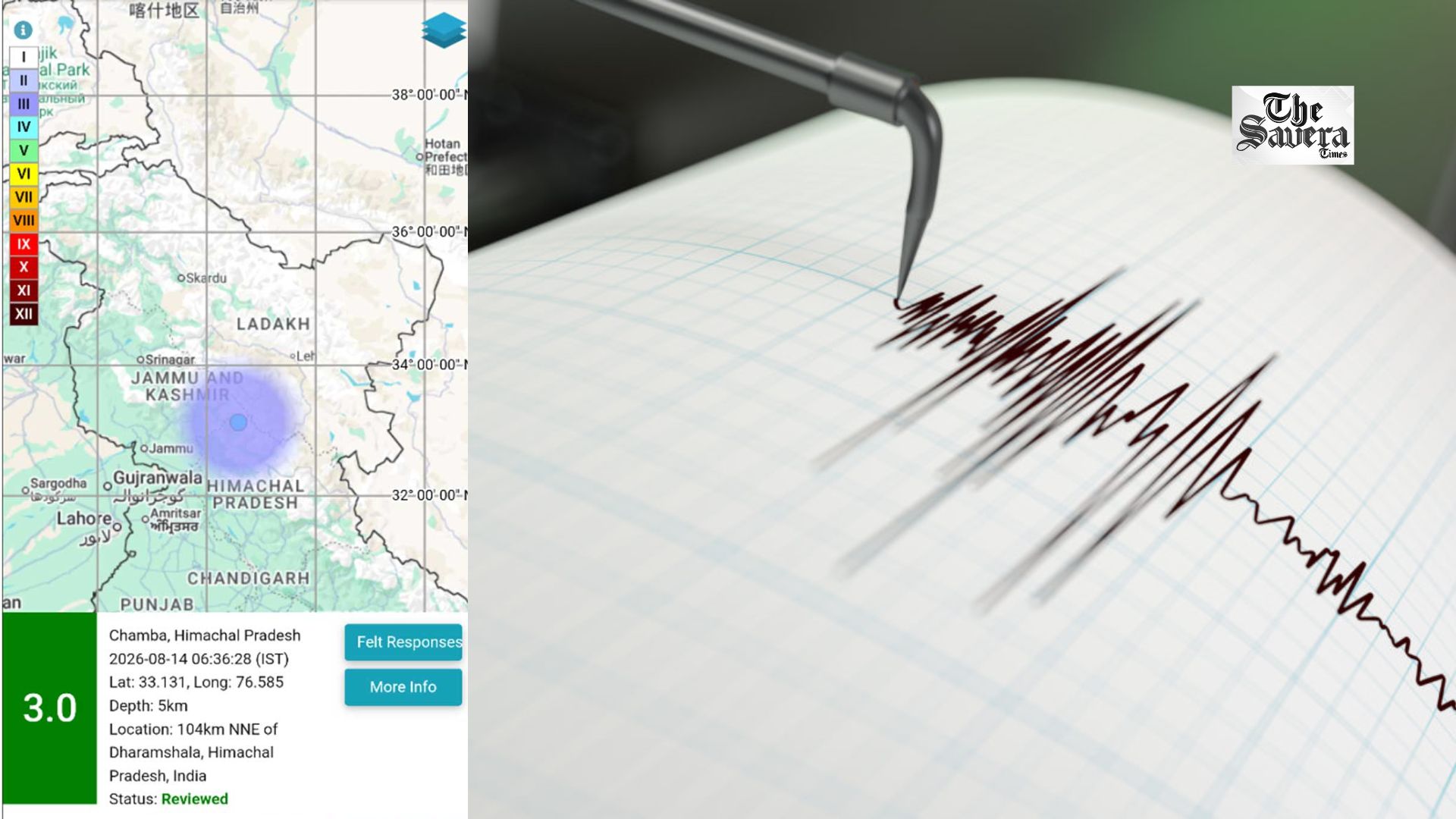
Chamba: An earthquake of magnitude 3.0 struck Chamba district in Himachal Pradesh early Friday morning, according to the National Centre of Seismology (NCS).
The earthquake occurred at 6:36 am, with the NCS recording its depth at 5 km below the Earth’s surface.
According to the NCS, the earthquake was recorded at latitude 33.131°N and longitude 76.585°E, with Chamba identified as the location.
EQ of M: 3.0, On: 14/08/2026 07:59:37 IST, Lat: 33.144 N, Long: 76.541 E, Depth: 10 Km, Location: Chamba, Himachal Pradesh.
For more information Download the BhooKamp App https://t.co/5gCOtjdtw0 @DrJitendraSingh @OfficeOfDrJS @DrNKalaiselvi @GSuresh_NCS @ndmaindia pic.twitter.com/oYCORcf6tZ— National Center for Seismology (@NCS_Earthquake) August 14, 2026
Earthquake recorded at shallow depth
The NCS shared the earthquake details on its website and in a post on X, confirming a magnitude of 3.0 and a depth of 5 km.
The earthquake falls in the category of a shallow earthquake, as earthquakes occurring at depths of up to 70 km are generally classified as shallow.
There were no immediate reports of casualties or damage following the tremor.
What makes an earthquake shallow or deep?
According to the United States Geological Survey (USGS), earthquakes can occur anywhere from the Earth’s surface to around 700 km below the surface.
For scientific purposes, earthquakes are broadly divided into three categories based on their depth. Earthquakes occurring between 0 and 70 km are classified as shallow, those between 70 and 300 km as intermediate, and those between 300 and 700 km as deep.
The USGS generally uses the term deep-focus earthquake for earthquakes occurring at depths greater than 70 km.
The latest tremor in Chamba was recorded at a depth of just 5 km.
Jaipur: The Supreme Court of India on Wednesday has provided a major relief to the Former Rajasthan Public...
New Delhi: Cockroach Janta Party (CJP) founder Abhijeet Dipke on Friday defended the party’s protests, asserting that peaceful...
New Delhi: The Supreme Court on Friday issued notice to Shiv Sena(UBT) Rajya Sabha member Sanjay Raut and...
New Delhi: Tesla CEO Elon Musk on Friday unveiled a new version of his Roadster sports car. During...
Rayachoti (Andhra Pradesh): Andhra Pradesh’s Annamayya district was rocked by violence on Friday as several vehicles were set...
Abhijeet Dipke criticised administrative restrictions ahead of CJP’s ‘Lehra Do Tiranga’ rally in Delhi, arguing that demanding government...

Aries: The day will be auspicious...