Last Updated: October 16, 2026
Last Updated: October 16, 2026






The heat in Haryana has begun to show its intensity as early as late February. Maximum temperatures across the state are well above normal, with Hisar reaching over 32 degrees Celsius. According to Meteorological Department data for February 27, nine cities in the state recorded maximum temperatures above 30 degrees Celsius, indicating an early onset of heat.
Daytime and nighttime temperatures remain above normal. Meanwhile, a weak western disturbance is approaching today. Its impact has predicted cloudy skies and drizzle. Meteorologists predict that two western disturbances will occur one after the other until March 4th. This will cause the weather to remain volatile.
Temperature in Hisar was 6.3 degrees above normal.
The state’s highest temperature was recorded at 32.7 degrees Celsius in Hisar, about 6.3 degrees above normal. Temperatures above 30 degrees Celsius were also recorded in Bhiwani, Mahendragarh, Nuh, Gurugram, Canal Rest House in the Rohtak region, Mandkola, and Sonipat.
The average maximum temperature in the state increased by about 1 degree compared to the previous day and remained about 4.7 degrees above normal. Clear weather and dry winds are contributing to the steady increase in daytime temperatures.
Minimum temperature also higher than normal
Minimum temperatures across the state dropped slightly, but remained above normal. The state’s average minimum temperature was about 2 degrees above normal. The lowest minimum temperature was recorded at 9.2 degrees Celsius at the Canal Rest House in Sargathal, Sonipat.
The minimum temperature was 12.5 degrees in Hisar, 11.7 degrees in Karnal, 12.8 degrees in Chandigarh, and 12.8 degrees in Rohtak. With night temperatures not dropping significantly, the heat is being felt more during the day. This situation could also affect crop growth.
A former sarpanch allegedly shot his 26-year-old son, Murari, in Taloda village of Jind district amid a dispute...

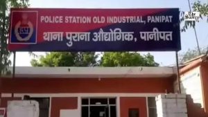
An administrative team and police returned without taking possession of a house in Panipat after the homeowner allegedly...
Punjab AGTF and Haryana STF arrested Gurlal Singh in connection with Ajmeet Singh’s September 11 murder in Naushera...

Pinky Yadav, daughter of former Haryana BJP district president Dayaram Yadav, has been reverted from Junior Engineer to...

SFI leader Amit Pilana from Rohtak alleged that police used batons, dragged protesters and mistreated women during the...

Haryana Congress MPs, MLAs and senior leaders gather at Bhupinder Singh Hooda’s residence before the INDIA bloc’s march...

Aries: The day will be auspicious...