Last Updated: October 11, 2026
Last Updated: October 11, 2026





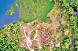
India is home to endangered wildlife like the Asian elephant (Elephas maximus), tiger (Panthera tigris), and leopard (Panthera pardus) and approximately 1.4 billion people. Use this set of ideas to engage your classroom in learning about biodiversity and conservation challenges and efforts in India.
India is a country in South Asia with a rich cultural and natural heritage. It’s the seventh largest in the world, approximately 3.25 million sq.km, and is known for its diverse range of climates and landscapes from the Himalaya in the north to the spice fields and biodiverse-rich tropical forests in the south. It’s also home to iconic, yet endangered wildlife like the Asian elephant, tiger, and leopard. India’s population of 1.3 billion is expected to grow by 16 percent by 2030, and finding the balance between the needs of people and the rest of the environment will continue to be a challenge. Use this set of ideas to engage your classroom in learning about biodiversity and conservation challenges and efforts in India.
Search for India in Google Earth and fly to this country. India is located in a geographically rich region of the world with many neighboring countries. Have students identify the number of countries that India shares a border with (the answer is six). Using the info cards that pop up on the top right of the screen, have students click Points of Interest in India and read about some of the places featured. Have students choose one to investigate further. They can click on the round blue icon on the info card to fly to this place and then click the text to pull up a page with more information. Students can make a list of five of the most interesting things they learned about the destination.
Have students read the Google Earth Voyager story about National Geographic Explorer Krithi Karanth’s work in India. Then have students visit Anshi National Park in Google Earth, one of the locations where Krithi works.
Since one of the issues facing wildlife in the park is conflict with humans, have your students become investigators to study what signs of human settlement they can identify from the air. Students should look for signs of habitations such as houses and other structures, infrastructure such as roads or fences, and signs of farming; often you can identify crops planted in rows, or rectangular or polygonal shapes that are agricultural fields. Students can take screenshots of these to keep a catalog of examples.
Then lead a discussion with students to build on their findings. Ask: What issues might wildlife face when they come into contact with human settlements? What issues might humans face from wildlife living in the park? What are some possible ways of dealing with these issues that can work for humans and wildlife? You can go further by doing this activity on protecting wildlife or having students read more about Krithi’s work.
Have students visit the website for the IUCN Red List and search for “Leopard” (Leopard: panthera pardus). Select “View on Map” to observe the range of where leopards can be found. You can have students read the encyclopedia entry on species range for more background. Then have students explore protected areas of India using Protected Planet, the interface for the World Database on Protected Areas. Ask them to compare the two maps and consider where the protected areas and leopard ranges intersect. Lead a class discussion about some of the issues humans and leopards might face, based on what students can learn from the maps. Then share this article and photo with students of a leopard at night in a neighborhood in Mumbai, India. Students can open National Geographic MapMaker and search for the place mentioned in the article (Sanjay Gandhi National Park) to explore it more.
India is the most populated country in the world, but it is the seventh largest country on Earth in terms of size. Have your students open National Geographic MapMaker and explore this population density map to explore population density in India. Click on “Map Layer” to learn how high population density is depicted in blue and low population is depicted in yellow. Ask students to make geographic observations of where people live in India: What patterns can they observe (e.g., people seem to be concentrated on the coast and also near the borders with Nepal and Bangladesh)? Have students hypothesize why people live where they do: What factors affect where people live? Students can turn off the population density data by clicking on the icon in Map Layer that looks like an eye to explore the landscape and see what other geographic factors they can identify. Go further with the topic of population density using this activity or this encyclopedia entry on density.
Have your students read this encyclopedia entry on biodiversity for background on biodiversity hotspots. Lead a discussion about the term “endemic species.” Ask: Where do you think you would find a lot of endemic species? In what types of environments? Why do you think studying endemic species is important? India includes parts of three areas that scientists consider to be biodiversity hotspots: the Western Ghats mountain range, the Himalaya mountain range, and the Indo-Burma region. Have students open a map of terrestrial biodiversity hotspots in National Geographic MapMaker and locate the three biodiversity hotspots in India. Students can write geographic descriptions of these areas. Then assign groups of students to different continents to look at other biodiversity hotspots around the world. Have the groups make geographic observations of what they see (for example, many biodiversity hotspots are on islands or include mountain ranges) and then come together as a class to compare.
Snow leopards (Panthera uncia) are an endangered species found only in the mountains of Central Asia, including parts of northwestern India. Have students read background information on snow leopards and write a geographic question. Then have students visit the website for the IUCN Red List and search for “Snow Leopard”. Select “View on Map” to observe the geographic range of where they live. Students can observe and discuss what types of landscapes they live in and in which countries. Based on what students learn about the snow leopard habitat, lead a discussion on the types of adaptations that snow leopards have developed that make them uniquely fit for those habitats. Students should also revisit and answer the geographic question they developed. Students can read this encyclopedia entry on adaptation for more background on this topic. Then go further with adaptation with these activities.
Have students visit the website for the IUCN Red List and search for “Leopard” (Leopard: panthera pardus). Select “View on Map” to observe the range of where leopards can be found. You can have students read the encyclopedia entry on species range for more background. Then have students explore protected areas of India using Protected Planet, the interface for the World Database on Protected Areas. Ask them to compare the two maps and consider where the protected areas and leopard ranges intersect. Lead a class discussion about some of the issues humans and leopards might face, based on what students can learn from the maps. Then share this article and photo with students of a leopard at night in a neighborhood in Mumbai, India. Students can open National Geographic MapMaker and search for the place mentioned in the article (Sanjay Gandhi National Park) to explore it more.
India is the most populated country in the world, but it is the seventh largest country on Earth in terms of size. Have your students open National Geographic MapMaker and explore this population density map to explore population density in India. Click on “Map Layer” to learn how high population density is depicted in blue and low population is depicted in yellow. Ask students to make geographic observations of where people live in India: What patterns can they observe (e.g., people seem to be concentrated on the coast and also near the borders with Nepal and Bangladesh)? Have students hypothesize why people live where they do: What factors affect where people live? Students can turn off the population density data by clicking on the icon in Map Layer that looks like an eye to explore the landscape and see what other geographic factors they can identify. Go further with the topic of population density using this activity or this encyclopedia entry on density.
Have your students read this encyclopedia entry on biodiversity for background on biodiversity hotspots. Lead a discussion about the term “endemic species.” Ask: Where do you think you would find a lot of endemic species? In what types of environments? Why do you think studying endemic species is important? India includes parts of three areas that scientists consider to be biodiversity hotspots: the Western Ghats mountain range, the Himalaya mountain range, and the Indo-Burma region. Have students open a map of terrestrial biodiversity hotspots in National Geographic MapMaker and locate the three biodiversity hotspots in India. Students can write geographic descriptions of these areas. Then assign groups of students to different continents to look at other biodiversity hotspots around the world. Have the groups make geographic observations of what they see (for example, many biodiversity hotspots are on islands or include mountain ranges) and then come together as a class to compare.
The CJP clarified that a petition circulating on social media over the alleged detention of its leaders was...
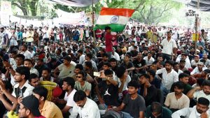
CJP founder Abhijeet Dipke and leaders Saurav Das and Ashutosh Ranka were placed under preventive arrest amid security...

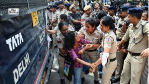
India has criticised the UN human rights office’s concerns over police action against CJP protesters in Delhi, citing...
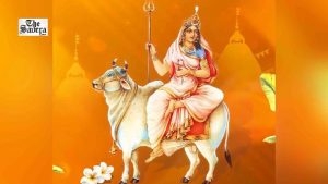
Uttar Pradesh CM Yogi Adityanath and Union Minister Nitin Gadkari greet people on the first day of Sharadiya...
New Delhi: Delhi Traffic Police has announced traffic restrictions and possible diversions at around 30 key intersections and...
Pakistan’s religious minorities continued to face violence, discrimination and persecution throughout 2025, with blasphemy accusations and minority women...
Aries: The day will be auspicious...