Last Updated: October 16, 2026
Last Updated: October 16, 2026





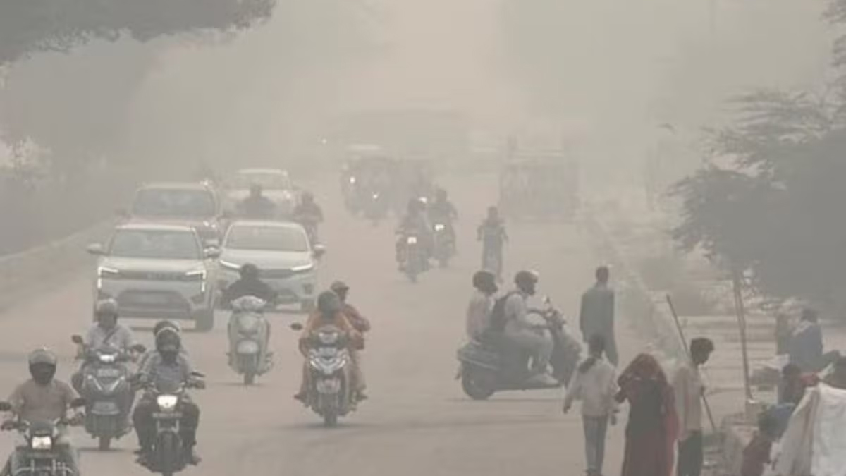
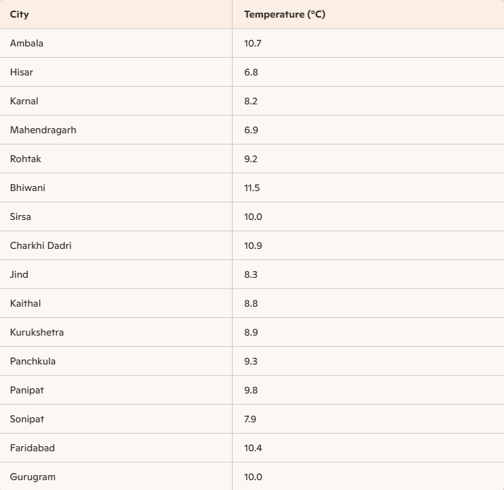
The minimum temperature in Hisar on Sunday was 6.8 degrees Celsius, the lowest in the state. Furthermore, it was also the lowest this season so far. According to weather experts, a weak western disturbance on November 17th will cause a slight increase in day and night temperatures.
Meteorologist Dr. Chandramohan explained that the effects of the snowfall in the northern mountainous regions are being felt continuously in the northern plains, especially in Haryana, NCR, and Delhi. Typically, after the western disturbance activates in December and snowfall in the northern mountainous regions, northern winds blow towards the plains, causing temperatures to drop, leading to a cold wave in the second half of December.
However, this year, due to the continuous western disturbance in the northern mountainous regions since October, snowfall in the northern mountainous regions, and rain in the plains, the cold wave is beginning in November. On Sunday night, temperatures dropped below 10 degrees Celsius in all but two or three districts.
This is how the weather will be in the future
A western disturbance will become active on the night of November 17th. However, this disturbance will be weak, resulting in snowfall only in the hilly areas. Temperatures will rise slightly upon its arrival, but will drop again after it passes. Another disturbance will then arrive on November 21st. This will likely lead to cloud cover in some areas. Temperatures will drop further after its passage.
Here are the Minimum Temperatures of major cities across Haryana
A former sarpanch allegedly shot his 26-year-old son, Murari, in Taloda village of Jind district amid a dispute...

An administrative team and police returned without taking possession of a house in Panipat after the homeowner allegedly...
Punjab AGTF and Haryana STF arrested Gurlal Singh in connection with Ajmeet Singh’s September 11 murder in Naushera...

Pinky Yadav, daughter of former Haryana BJP district president Dayaram Yadav, has been reverted from Junior Engineer to...

SFI leader Amit Pilana from Rohtak alleged that police used batons, dragged protesters and mistreated women during the...

Haryana Congress MPs, MLAs and senior leaders gather at Bhupinder Singh Hooda’s residence before the INDIA bloc’s march...
Aries: The day will be auspicious...