Last Updated: October 16, 2026
Last Updated: October 16, 2026





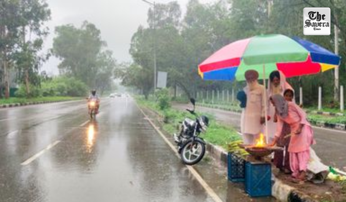
The weather in Punjab and Chandigarh has taken a turn. Two days after sunshine, Today and tomorrow, there is a possibility of thunderstorms accompanied by lightning and hailstorms in some locations. Winds are expected to blow at 40 to 50 km/h. In light of this, the Meteorological Department has issued an ‘Orange Alert.’
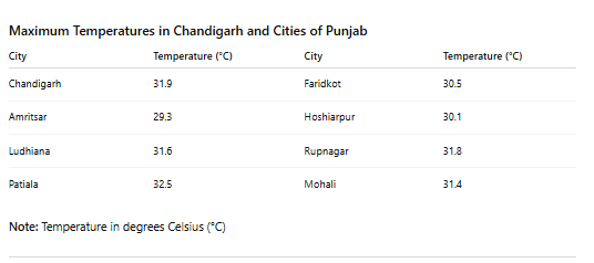
Meanwhile, there is also a likelihood of rainfall in several areas. Amidst these developments, the state’s average maximum temperature has risen by 1.3 degrees Celsius.
Storms and Hailstorms in 13 Districts
According to the Meteorological Department, the weather pattern shifted following the arrival of a Western Disturbance in the mountainous regions. The weather across nearly all districts is expected to be impacted during this period.
While 13 districts face the possibility of both hailstorms and thunderstorms, other districts are likely to experience only thunderstorms and lightning. Specifically, Nawanshahr, Kapurthala, Jalandhar, Ludhiana, Sangrur, Fatehgarh Sahib, Rupnagar, Patiala, and Mohali are expected to witness thunderstorms. Furthermore, there is a possibility of both rain and hailstorms in Pathankot, Gurdaspur, Amritsar, Tarn Taran, Hoshiarpur, Bathinda, Barnala, Mansa, Sangrur, Nawanshahr, Kapurthala, Jalandhar, Ferozepur, Fazilka, Faridkot, Muktsar, Moga, Ludhiana, Fatehgarh Sahib, Rupnagar, Patiala, and Mohali.
Western Distrubance active
A Western Disturbance is currently active in the vicinity of Jammu and Kashmir, functioning as an upper-air cyclonic circulation and consequently altering the weather conditions.
Additionally, a trough has formed at an altitude of 1.5 kilometers, further influencing the weather pattern. A new Western Disturbance is expected to arrive starting April 11, which could once again lead to increased rainfall, thunderstorms, and cloud cover across Northwest India. Crops may sustain damage during this period.
New Delhi: The Union Ministry of Home Affairs (MHA) has sought detailed reports from the Punjab government on...

The killing of Bikramjit Singh in Gurdaspur, two days after anti-drug activist Parvinder Singh Jhota was shot dead...

Union Home Minister Amit Shah has questioned Punjab’s law and order situation over drugs, gangsterism and the murder...
A Tips School bus crashed into a house in Jalandhar's Sodhal Industrial Area on Friday morning. One child...

Charanjit Singh Channi travelled in a tipper truck to a riverbank site at night as part of Mission...

Punjab is rapidly establishing itself as a key industrial hub in the country. According to the Punjab government...
Aries: The day will be auspicious...