Last Updated: October 21, 2026
Last Updated: October 21, 2026





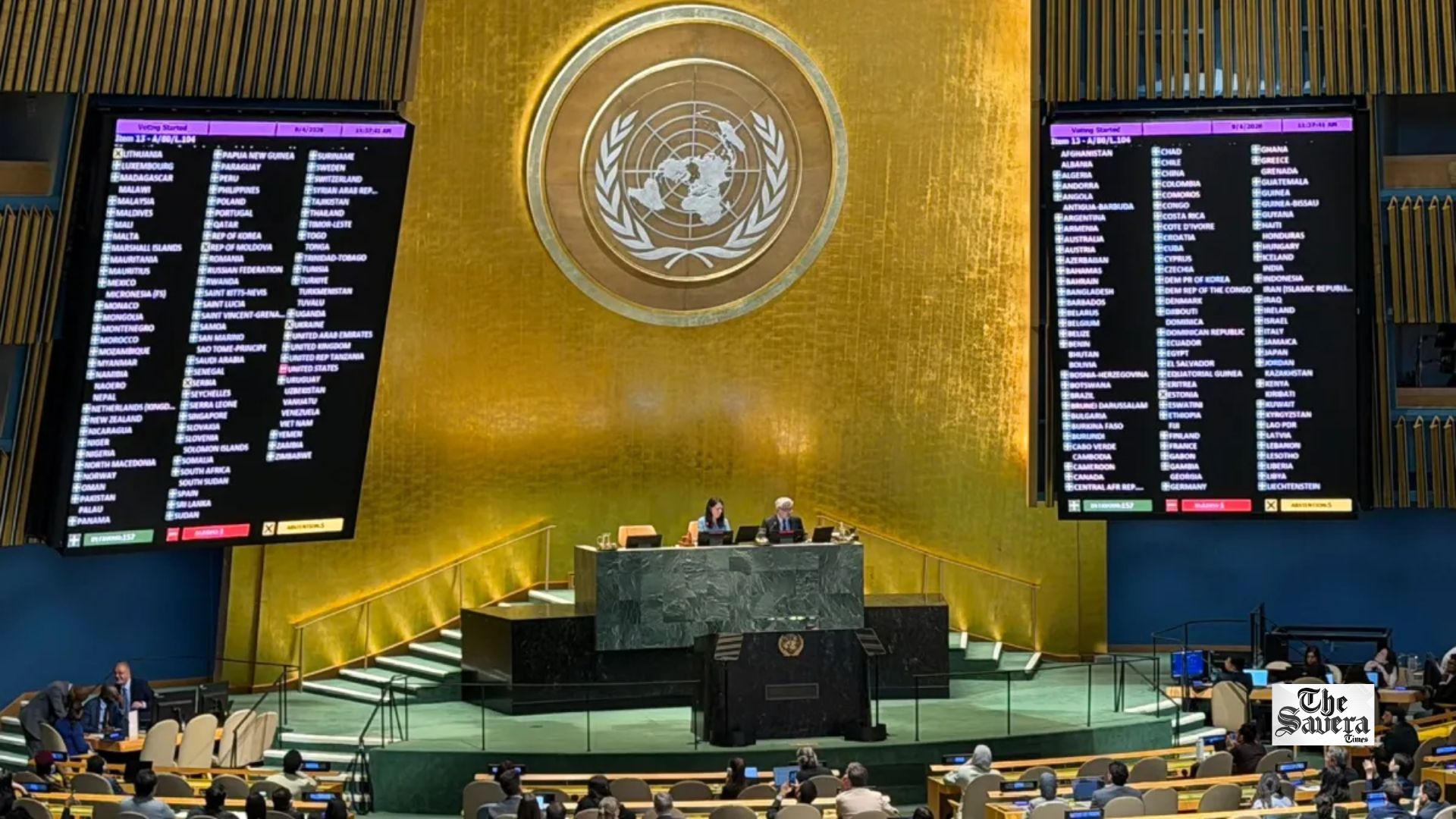
United Nations: The United Nations General Assembly has backed a resolution promoting a new world map that more accurately represents the relative size of continents, with 164 countries voting in favour, the United States voting against and six countries abstaining.
The resolution, spearheaded by Togo and backed by African countries, promotes the Equal Earth cartographic projection as a more accurate way to represent the world’s landmasses.
The move challenges the widespread use of the Mercator projection, a 16th-century map created by Flemish cartographer Gerardus Mercator primarily for maritime navigation. While the Mercator projection preserves angles and shapes useful for navigation, it significantly distorts the relative size of landmasses, particularly as they move away from the Equator.
🎉Congratulations to the delegation of Togo 🇹🇬 on the adoption this morning by the #UNGA of resolution A/80/L.104, “Correct the Map”, an @_AfricanUnion initiative promoting more accurate and equitable global cartographic representation, particularly of #Africa.
A significant… pic.twitter.com/oxZCbeMUTt
— African Union Mission to the UN (@AfricanUnionUN) September 4, 2026
However, the UN resolution does not ban the Mercator projection or make the Equal Earth map compulsory. Instead, it encourages countries, international organisations, educational institutions and others to consider projections that provide a more accurate representation of continental areas.
Why does Africa look bigger on the new map?
The difference comes from the way a three-dimensional Earth is represented on a flat surface.
On the Mercator map, regions close to the North and South Poles appear much larger than their actual area. As a result, Europe and North America look disproportionately large, while Africa, South America and other regions closer to the Equator appear smaller.
The Equal Earth projection, introduced by cartographers in 2018, is designed as an equal-area projection. It preserves the relative surface areas of continents while attempting to keep their shapes close to how they appear on a globe.
One striking comparison is Africa and Greenland. On commonly seen Mercator maps, Greenland can appear comparable in size to Africa, even though Africa’s actual area is about 14 times larger.
The new projection therefore makes Africa appear substantially larger, while North America and Europe appear smaller in comparison.
Why did the US oppose the UN resolution?
The United States was the only country to vote against the resolution.
Washington criticised the initiative as an ideological exercise and argued that the UN should concentrate on more pressing global challenges rather than debates over centuries-old map projections.
The US representative said the organisation was spending time discussing 16th-century map projects and their links to concepts such as reparations and “cognitive justice”, instead of focusing on international peace and other major problems.
US officials also argued that resolutions of this nature contribute to concerns about the UN’s credibility.
The disagreement therefore goes beyond cartography. Supporters see the change as a correction to a longstanding distortion in how the world is visually represented, while the US views the initiative as part of a broader ideological agenda.
Togo says maps shape how people see the world
Togo, which spearheaded the resolution, argued that maps are not simply neutral technical tools because they influence how people understand geography.
Togo’s Foreign Minister Robert Dussey said maps influence education, imagination and public perceptions. He argued that distorted representations can be passed from one generation to another.
For supporters, the issue is therefore about more than changing a picture on classroom walls. They see more accurate maps as a way of correcting geographic misconceptions and challenging historical patterns in which Africa and other equatorial regions have often appeared visually smaller than they actually are.
France supports the change
France was among the countries supporting the resolution and announced that it would move away from the Mercator projection.
French Foreign Minister Jean-Noël Barrot said the traditional map gives disproportionate visual prominence to countries such as the United States, Russia and China, while making Africa, Latin America and Southeast Asia appear smaller.
Barrot acknowledged that changing a map does not change the world, but argued that correcting a distorted representation can provide a more accurate picture of it.
France’s support also comes against the backdrop of its efforts to improve relations with African countries, particularly former colonies where relations have sometimes been strained.
Not everyone supported the new projection
The vote was overwhelmingly in favour, but the resolution did not receive unanimous support.
Ukraine was among the countries that abstained, with its UN envoy raising concerns about the depiction of Ukrainian territory under Russian occupation on Equal Earth maps.
Ukraine argued that the way the disputed territories are represented could conflict with principles of sovereignty and territorial integrity.
This highlights an important point: while the debate is largely about geographic accuracy and map projections, world maps can also carry political implications because they show national borders and territories.
Will the world actually stop using the Mercator map?
Not immediately.
The UN resolution is not a legally binding order requiring every country to abandon Mercator maps. Instead, it encourages the adoption and promotion of equal-area projections such as Equal Earth in areas including education, mapping and public communication.
The Mercator projection will also continue to have practical uses, particularly in navigation, where its preservation of angles makes it useful for plotting courses.
The significance of the UN vote is therefore less about the immediate disappearance of an old map and more about encouraging governments, schools, organisations and technology companies to use maps that provide a more accurate visual comparison of the world’s continents.
Ten people were killed and 44 others injured in a horrific road accident in Pakistan's Punjab province. The...

North Korean leader Kim Jong-un's influential sister, Kim Yo-jong, and a military marshal inspected fortification work along the...

New Delhi: US Secretary of State Marco Rubio has assured India that America’s relations with any country in...
The family of 5-year-old Fabiana Cabello in New York City, USA, is in deep shock after her death....

Cockroach Janata Party (CJP) leaders Sourav Das and Ashutosh Ranka withdrew their petition from the Delhi High Court...
A Cessna 177A crashed onto Capitol Expressway in San Jose on October 17. Three people on board, including...

Aries: The day will be auspicious...