Last Updated: November 2, 2026
Last Updated: November 2, 2026




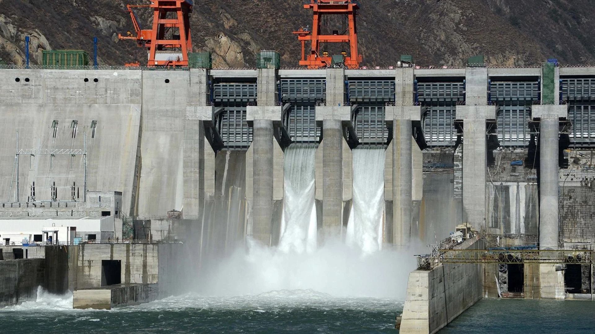
China’s efforts to harness immense natural power are unfolding in a region prone to considerable geological instability. The October 22 earthquake underscores that tectonic activity is not merely a feature of the region’s geological past but remains an active threat, posing risks that must be factored into the design and operation of major infrastructure projects. On October 22, 2026, a powerful magnitude 7.0 earthquake struck Baqing County in Nagqu, Tibet, killing at least 16 people, injuring dozens, and destroying hundreds of homes. According to the US Geological Survey (USGS), the earthquake resulted from movement along a normal fault within the Tibetan Plateau, where the continuing collision of the Indian and Eurasian tectonic plates creates enormous geological stresses. The plateau is still being pushed upward and stretched eastward and westward. This was no isolated event. Since 1900, the Tibetan Plateau and its surrounding regions have experienced 29 earthquakes of magnitude 7.0 or greater. The devastating 1950 Assam-Tibet earthquake reached magnitude 8.6 and killed 4,800 people, while the 2010 Yushu earthquake in neighbouring Qinghai claimed more than 2,500 lives. The latest earthquake is another reminder that the Himalayas and Tibetan Plateau remain among the world’s most geologically unstable regions. The latest earthquake struck less than two months after another major disaster in the Himalayas. On August 26, a massive mass of glacier ice and rock collapsed near the Nepal-Tibet border, triggering a destructive surge of water, mud and boulders. The two disasters, one triggered by seismic activity and the other by the collapse of glacier ice and rock, highlight different aspects of the same underlying vulnerability. They also raise serious concerns about the ability of China’s massive hydropower complex under construction on the Yarlung Tsangpo River in southeastern Tibet to withstand such extreme natural events. Although neither disaster occurred at the project site, both illustrate the geological and environmental hazards that major infrastructure throughout the Himalayas must confront. The question matters because the Yarlung Tsangpo becomes the Brahmaputra upon entering India and eventually flows into Bangladesh, linking the safety of China’s upstream engineering projects to the lives and livelihoods of millions downstream. China’s project, launched in July 2025, is among the most ambitious hydropower undertakings in history. With an estimated investment of 1.2 trillion yuan (about $170 billion), it involves five cascading hydropower stations designed to exploit the river’s extraordinary energy potential before it enters India, where it becomes the Brahmaputra River, which flows through Bangladesh to the Bay of Bengal. A report published in 2026 in Palaeogeography, Palaeocl imatology, Paleoecology, which identified six devastating prehistoric floods in the Yarlung Tsangpo Gorge system following natural dam failures. The findings, it said, underscore that the threat of exceptionally large floods is grounded in the Tsangpo River’s geological past rather than being merely a hypothetical engineering concern. Moreover, China’s unwillingness to fully cooperate with its downstream neighbours has turned the nearly 4,900km Mekong River into a battleground of geopolitics rather than a symbol of regional cooperation. Flowing from the Tibetan Plateau through China’s Yunnan province into Southeast Asia, the river is more than a geographical feature, serving as a lifeline for over 60 million people across Laos, Cambodia, Thailand, Vietnam and Myanmar. “China’s behaviour toward upstream nations such as Kazakhstan and Mongolia stands in sharp contrast to its approach on the Mekong. With these northern neighbours, Beijing has signed binding water-sharing agreements and established joint commissions to manage rivers like the Irtysh and the Ili. The difference lies in strategic necessity: Kazakhstan and Mongolia are upstream, or midstream states themselves, and their water disputes directly affect China’s own border provinces, industrial hubs, and domestic stability. Cooperation here is not framed as goodwill but as a matter of self-interest; China needs predictable flows to sustain Xinjiang’s border security, agriculture and industry, and it cannot afford prolonged disputes with countries that share sensitive borders. Thus, treaties and technical coordination become instruments of stability, ensuring China’s own water security while projecting an image of responsible regional leadership. By contrast, the Mekong reflects a markedly different strategic calculus, with China occupying the dominant position as the upstream power and facing no existential threat from the downstream nations. Laos, Cambodia, Thailand and Vietnam remain heavily dependent on the river, but their leverage is far weaker than that of countries such as Kazakhstan or Mongolia. Beijing sees little incentive to bind itself to restrictive agreements when unilateral dam operations provide both hydropower benefits and geopolitical leverage. Cooperation is kept voluntary, symbolic, and selective, allowing China to retain maximum control while using water flows as a tool of influence in Southeast Asia. In short, China cooperates where its own security is at stake, as with Kazakhstan and Mongolia, but resists binding commitments where it can dominate, as on the Mekong. It is warned that Vietnam’s rice bowl and Cambodia’s fisheries could face severe disruption if river flows remain unpredictable. It noted that declining sediment levels are also threatening biodiversity and accelerating erosion. Distrust in China’s intentions could destabilise ASEAN-China relations, undermining broader regional integration. With droughts and floods intensifying, unilateral dam operations will exacerbate vulnerabilities. The Mekong is no longer just a river; it is a geopolitical fault line where livelihoods, food security, and regional trust are at stake.
Dhaka: Bangladesh has witnessed a disturbing escalation in mob violence since the fall of the Sheikh Hasina-led Awami...

The CBI has extradited Sourabh Chandrakar, a key accused in the Mahadev online betting app case, from Oman...

National Security Advisor Ajit Doval has arrived in Hanoi on an official visit to Vietnam. His visit comes...

Pakistan is home to nearly half of the people living in extreme poverty across the MENAAP region. The...
Afghan security forces have dismantled eight clandestine heroin laboratories and arrested 17 suspected traffickers in Ghor province. The...

Trump says the US can strike Iran's remaining nuclear sites within 10 minutes and claims Tehran wants a...

Aries: The day will be auspicious...