Last Updated: October 10, 2026
Last Updated: October 10, 2026





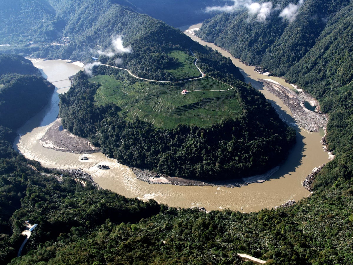
China’s mega hydropower project on the Yarlung Tsangpo river in Tibet, near the heavily militarised border with India, warrants urgent global scrutiny amid growing concern over its devastating consequences.
Given the project’s enormous scale and its location in a geologically complex, seismically active Himalayan region, it demands rigorous independent oversight, greater transparency and a thorough evaluation of cross-border risks.
Citing a pivotal 2026 study by Chinese geologists, Somesh Goyal, former Director General of Police of Himachal Pradesh, said the research identified the Paizhen Fault—a highly active fracture since the Pleistocene era—as lying directly beneath or significantly influencing the project area.
The researchers issued a stark warning that the fault could threaten the structural stability of dams, tunnels, roads, bridges and the reservoir itself, Goyal wrote in India Narrative.
As the river flows into Arunachal Pradesh, it is known as the Siang, then transitions to the Brahmaputra in Assam and eventually reaches Bangladesh. As the principal lower-riparian country downstream, India faces valid and pressing concerns about sudden changes in water flow, sedimentation, flood management, lean-season flows, and strategic vulnerability due to the dam’s position near a politically sensitive international boundary.
It is unacceptable that India and Bangladesh, as downstream nations, currently lack comprehensive access to the project’s geological assessments, seismic risk models, dam-break scenarios, emergency response plans, reservoir operating protocols, environmental impact evaluations, sediment studies, and real-time hydrological data.
In response to these alarming circumstances, India has made it clear that it expects China to resume sharing hydrological data related to the Yarlung Tsangpo/Brahmaputra without delay.
In view of the potential risks, a multinational expert panel—involving China, India, Nepal, Bhutan and international specialists—must conduct a comprehensive and independent assessment of the Paizhen Fault, seismic hazards, slope stability, tunnel safety, landslide risks, and potential dam-break scenarios.
Additionally, China must provide India and Bangladesh with continuous upstream river flow and earthquake data, rather than relying solely on periodic exchanges. Countries that share a river in such fragile geographies must have a right to independent information, prior consultation, real-time data, and credible guarantees against catastrophic downstream consequences.
Ukrainian President Volodymyr Zelensky has criticised Donald Trump’s reported agreement to allow Russian diesel supplies to global markets,...

A 7.2-magnitude earthquake struck Panama on Friday, shaking buildings in Panama City and prompting tsunami alerts. Panama Canal...

Russian President Vladimir Putin says proposed Russian oil supplies to the US could benefit the global economy following...

Sharjah, UAE: All 22 Indian seafarers aboard the Panama-flagged crude oil tanker MT GEM NO. 2 are safe...
China is facing a human resources problem as the country’s younger generation sees technical education as lower in...

~Abhishek Vij Crude oil and natural gas exported from Gulf nations to half the world form the energy...